Dosya:Baltic states location map.svg

Orijinal dosya (SVG dosyası, sözde 660 × 992 piksel, dosya boyutu: 358 KB)
Özet
| Açıklama |
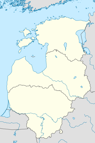
Deutsch: Positionskarte der baltischen Staaten
Quadratische Plattkarte, N-S-Streckung 184 %. Geographische Begrenzung der Karte:
English: Location map of the Baltic states
Equirectangular projection, N/S stretching 184 %. Geographic limits of the map:
|
|
| Tarih | ||
| Kaynak |
Yükleyenin kendi çalışması, using
|
|
| Yazar | NordNordWest | |
| İzin (Bu dosyanın tekrar kullanımı) |
Bu dosya, Creative Commons Atıf-Benzer Paylaşım 3.0 Almanya lisansı ile lisanslanmıştır.
 Bu dosya, Creative Commons Atıf-Benzer Paylaşım 3.0 Taşınmamış lisansı ile lisanslanmıştır
|


|
This map has been made or improved in the German Kartenwerkstatt (Map Lab). You can propose maps to improve as well.
|
Dosya geçmişi
Dosyanın herhangi bir zamandaki hâli için ilgili tarih/saat kısmına tıklayın.
| Tarih/Saat | Küçük resim | Boyutlar | Kullanıcı | Yorum | |
|---|---|---|---|---|---|
| güncel | 23.01, 1 Şubat 2011 | | 660 × 992 (358 KB) | wikimediacommons>NordNordWest | == {{int:filedesc}} == {{de|Positionskarte der baltischen Staaten}} Quadratische Plattkarte, N-S-Streckung 184 %. Geographische Begrenzung der Karte: * N: 60.4° N * S: 53.7° N * W: 20.4° O * O: 28.6° O {{en|Location map of th |