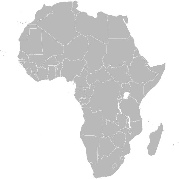
Dosya:BlankMap-Africa.svg
bilgipedi.com.tr sitesinden

Orijinal dosya(SVG dosyası, sözde 1.000 × 1.000 piksel, dosya boyutu: 184 KB)

Bu dosya Wikimedia Commons deposunda bulunmaktadır ve diğer projeler tarafından kullanılıyor olabilir. Aşağıda dosya açıklama sayfasındaki açıklama gösteriliyor.

This dosya is saved in human-editable plain text format. Any editing of the image or creation of any derivative work should be performed using a text editor. Please do not upload edits saved or exported with Inkscape or similar vector graphics editors, as well as with automated tools such as SVG Translate.
Açıklama

Political map of Africa

Detailed SVG map with grouping enabled to connect all non-contiguous parts of a country's territory for easy colouring. Smaller countries can also be represented by larger circles to show their data easier. All countries are tagged by their ISO code. A thorough description of use and other instructions can be found on the instruction page for the World map.

The circles used to mark small countries have been reduced in size compared to BlankMap-World6.svg, also Gambia does not have a circle in this version.

For completion, per en:Africa#Territories and regions, Madeira (pt-30), Canary Islands (es-cn), Réunion (re), Mayotte (yt) and Saint Helena (sh) have been added to the map. Ceuta and Melilla were not added since they don't exist in BlankMap-World6.svg. To make these territories transparent simply use the style .sh, .pt-30, .es-cn, .yt, .re {opacity: 0;}
Tarih
Kaynak Based on BlankMap-World6.svg by Canuckguy et al.
Yazar Lokal_Profil
İzin
(Bu dosyanın tekrar kullanımı)
Public domain Bu iş yazarı Lokal_Profil tarafından kamu malı olarak yayınlanmıştır. Bu dünya çapında geçerlidir.

Bazı ülkelerde bu yasal olarak mümkün olmayabilir; öyleyse:
Lokal_Profil, bu işi herhangi bir amaç için, herhangi bir şart olmaksızın, yasalarca gerekli olmadıkça, herkesin kullanmasına izin veriyor.

Diğer sürümler

Bu dosyanın türev çalışmaları:

SVG gelişimi
InfoField
 
Bu SVG kaynak kodu geçerlidir.
 
Bu vektörel grafik başka bir SVG aracı ile oluşturuldu.

Altyazılar

Bu dosyanın temsil ettiği şeyin tek satırlık açıklamasını ekleyin.

Bu dosyada gösterilen öğeler

betimlenen

24 Mart 2007

image/svg+xml

aac4a13f4a52f180fb3a8df29e22ac9290456d74

188.248 bayt

1.000 piksel

1.000 piksel

Dosya geçmişi

Dosyanın herhangi bir zamandaki hâli için ilgili tarih/saat kısmına tıklayın.

Tarih/SaatKüçük resimBoyutlarKullanıcıYorum
güncel08.01, 29 Nisan 202008.01, 29 Nisan 2020 tarihindeki sürümün küçültülmüş hâli1.000 × 1.000 (184 KB)wikimediacommons>KaldariListing the actual European territories in the comments so that they aren't a mystery

Bu dosyayı kullanan sayfa yok.

Meta veri