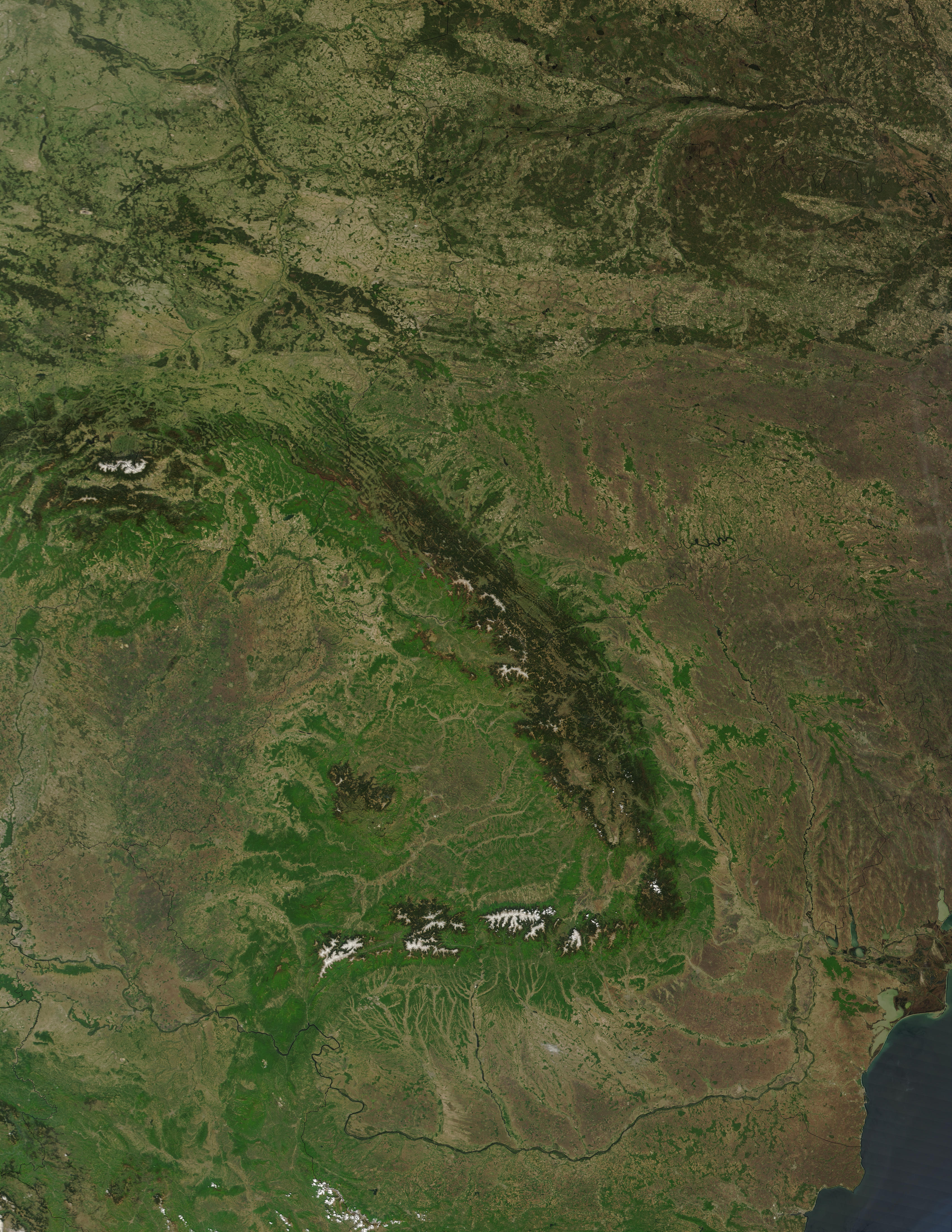
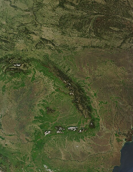
Dosya:Carpathians satellite.jpg
Bu önizlemenin boyutu: 463 × 599 piksel. Diğer çözünürlükler: 185 × 240 piksel | 371 × 480 piksel | 593 × 768 piksel | 791 × 1.024 piksel | 1.582 × 2.048 piksel | 3.400 × 4.400 piksel.
Orijinal dosya (3.400 × 4.400 piksel, dosya boyutu: 2,95 MB, MIME türü: image/jpeg)
Özet
| Açıklama |
English: Carpathian Mountains satellite image |
| Kaynak | Visible Earth page of NASA: http://visibleearth.nasa.gov/view_detail.php?id=5348 |
| Yazar | NASA |
Lisanslama
| Bu dosya NASA tarafından üretildiği için kamu malıdır. Aksi belirtilmediği sürece "NASA tarafından üretilen malzemenin telif hakkı olmadığı" NASA telif politikasında belirtilmiştir. (Bkz. Template:PD-USGov, NASA copyright policy page veya JPL Image Use Policy.) | ||
 |
Uyarılar:
|
Dosya geçmişi
Dosyanın herhangi bir zamandaki hâli için ilgili tarih/saat kısmına tıklayın.
| Tarih/Saat | Küçük resim | Boyutlar | Kullanıcı | Yorum | |
|---|---|---|---|---|---|
| güncel | 13.46, 30 Ağustos 2009 | | 3.400 × 4.400 (2,95 MB) | wikimediacommons>Qorilla | {{Information |Description={{en|1=Carpathian Mountains satellite image}} |Source=Visible Earth page of NASA: http://visibleearth.nasa.gov/view_detail.php?id=5348 |Author=NASA |Date= |Permission= |other_versions= }} Category:Carpathian Mountains [[Cat |
Dosya kullanımı
Aşağıdaki sayfa bu dosyayı kullanmaktadır: