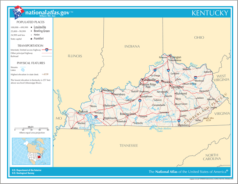
Dosya:Map of Kentucky NA.png

Bu önizlemenin boyutu: 776 × 600 piksel. Diğer çözünürlükler: 311 × 240 piksel | 621 × 480 piksel | 994 × 768 piksel | 1.280 × 989 piksel | 2.122 × 1.640 piksel.
Orijinal dosya (2.122 × 1.640 piksel, dosya boyutu: 1,36 MB, MIME türü: image/png)
Dosya geçmişi
Dosyanın herhangi bir zamandaki hâli için ilgili tarih/saat kısmına tıklayın.
| Tarih/Saat | Küçük resim | Boyutlar | Kullanıcı | Yorum | |
|---|---|---|---|---|---|
| güncel | 22.57, 14 Ağustos 2006 |  | 2.122 × 1.640 (1,36 MB) | wikimediacommons>Huebi~commonswiki | {{Information| |Description=Map of Kentucky |Source=[http://www.nationalatlas.gov National Atlas] }} Category:Maps of the United States Category:Maps of Kentucky {{PD-USGov-Atlas}} |
Dosya kullanımı
Bu dosyayı kullanan sayfa yok.

