Dosya:NASA Earth America 2002.jpg
bilgipedi.com.tr sitesinden

Bu önizlemenin boyutu: 600 × 600 piksel. Diğer çözünürlükler: 240 × 240 piksel | 480 × 480 piksel | 768 × 768 piksel | 1.024 × 1.024 piksel | 2.048 × 2.048 piksel.
Orijinal dosya (2.048 × 2.048 piksel, dosya boyutu: 588 KB, MIME türü: image/jpeg)
Bu dosya Wikimedia Commons deposunda bulunmaktadır ve diğer projeler tarafından kullanılıyor olabilir. Aşağıda dosya açıklama sayfasındaki açıklama gösteriliyor.
Özet
| AçıklamaNASA Earth America 2002.jpg |
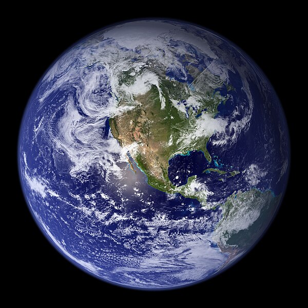
English: This spectacular “blue marble” image is the most detailed true-color image of the entire Earth to date. Using a collection of satellite-based observations, scientists and visualizers stitched together months of observations of the land surface, oceans, sea ice, and clouds into a seamless, true-color mosaic of every square kilometer (.386 square mile) of our planet. These images are freely available to educators, scientists, museums, and the public. This record includes preview images and links to full resolution versions up to 21,600 pixels across.
|
| Tarih | |
| Kaynak | https://www.flickr.com/photos/gsfc/4386822005/in/photostream/ |
| Yazar | NASA Goddard Space Flight Center Image by Reto Stöckl |
Lisanslama
| Public domainPublic domainfalsefalse |
| Bu dosya NASA tarafından üretildiği için kamu malıdır. Aksi belirtilmediği sürece "NASA tarafından üretilen malzemenin telif hakkı olmadığı" NASA telif politikasında belirtilmiştir. (Bkz. Template:PD-USGov, NASA copyright policy page veya JPL Image Use Policy.) |  | |
 |
Uyarılar:
|
Altyazılar
Bu dosyanın temsil ettiği şeyin tek satırlık açıklamasını ekleyin.
A picture of the Earth
Bu dosyada gösterilen öğeler
betimlenen
8 Şubat 2002
Dosya geçmişi
Dosyanın herhangi bir zamandaki hâli için ilgili tarih/saat kısmına tıklayın.
| Tarih/Saat | Küçük resim | Boyutlar | Kullanıcı | Yorum | |
|---|---|---|---|---|---|
| güncel | 16.46, 26 Eylül 2014 |  | 2.048 × 2.048 (588 KB) | wikimediacommons>Orange-kun | Larger file from the same source |
Dosya kullanımı
Aşağıdaki sayfa bu dosyayı kullanmaktadır:
Meta veri
Bu dosyada, muhtemelen fotoğraf makinesi ya da tarayıcı tarafından eklenmiş ek bilgiler mevcuttur. Eğer dosyada sonradan değişiklik yapıldıysa, bazı bilgiler yeni değişikliğe göre eski kalmış olabilir.
| Resim başlığı |
|
|---|---|
| Anahtar kelimeler |
|
| IIM sürümü | 4 |
"http://bilgipedi.com.tr/wiki/Dosya:NASA_Earth_America_2002.jpg" sayfasından alınmıştır