Dosya:KaiIchiranzu1806.jpg

Bu önizlemenin boyutu: 495 × 599 piksel. Diğer çözünürlükler: 198 × 240 piksel | 396 × 480 piksel | 697 × 844 piksel.
Orijinal dosya (697 × 844 piksel, dosya boyutu: 603 KB, MIME türü: image/jpeg)
Özet
| Açıklama |
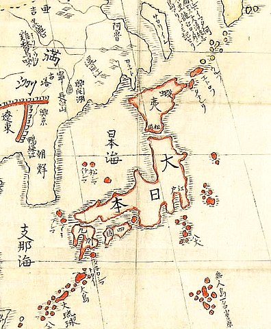
日本語: 山村才助『華夷一覧図』(1806年)国立公文書館所蔵。日本の地図。
English: Kai Ichiran Zu map of Japan (1806)
Bahasa Indonesia: Peta Jepang Kai Ichiran Zu (1806) |
| Tarih | |
| Kaynak | http://www.archives.go.jp/ |
| Yazar | 山村才助(Saisuke Yamamura, 1770-1807) |
Lisanslama
This photograph is in the public domain in Japan because its copyright has expired according to Article 23 of the 1899 Copyright Act of Japan (English translation) and Article 2 of Supplemental Provisions of Copyright Act of 1970. This is when the photograph meets one of the following conditions:
|
 | |
 |
To uploader: Please provide the source and publication date.
|
Dosya geçmişi
Dosyanın herhangi bir zamandaki hâli için ilgili tarih/saat kısmına tıklayın.
| Tarih/Saat | Küçük resim | Boyutlar | Kullanıcı | Yorum | |
|---|---|---|---|---|---|
| güncel | 18.13, 25 Ekim 2019 | | 697 × 844 (603 KB) | wikimediacommons>Artanisen | This is a high quality map of the same image. |
Dosya kullanımı
Aşağıdaki sayfa bu dosyayı kullanmaktadır: