Dosya:Subsurface erosion of soil into karst conduit by water level fluctuation.jpg
Bu önizlemenin boyutu: 446 × 600 piksel. Diğer çözünürlükler: 178 × 240 piksel | 357 × 480 piksel | 571 × 768 piksel | 761 × 1.024 piksel | 2.231 × 3.000 piksel.
Orijinal dosya (2.231 × 3.000 piksel, dosya boyutu: 2,83 MB, MIME türü: image/jpeg)
Özet
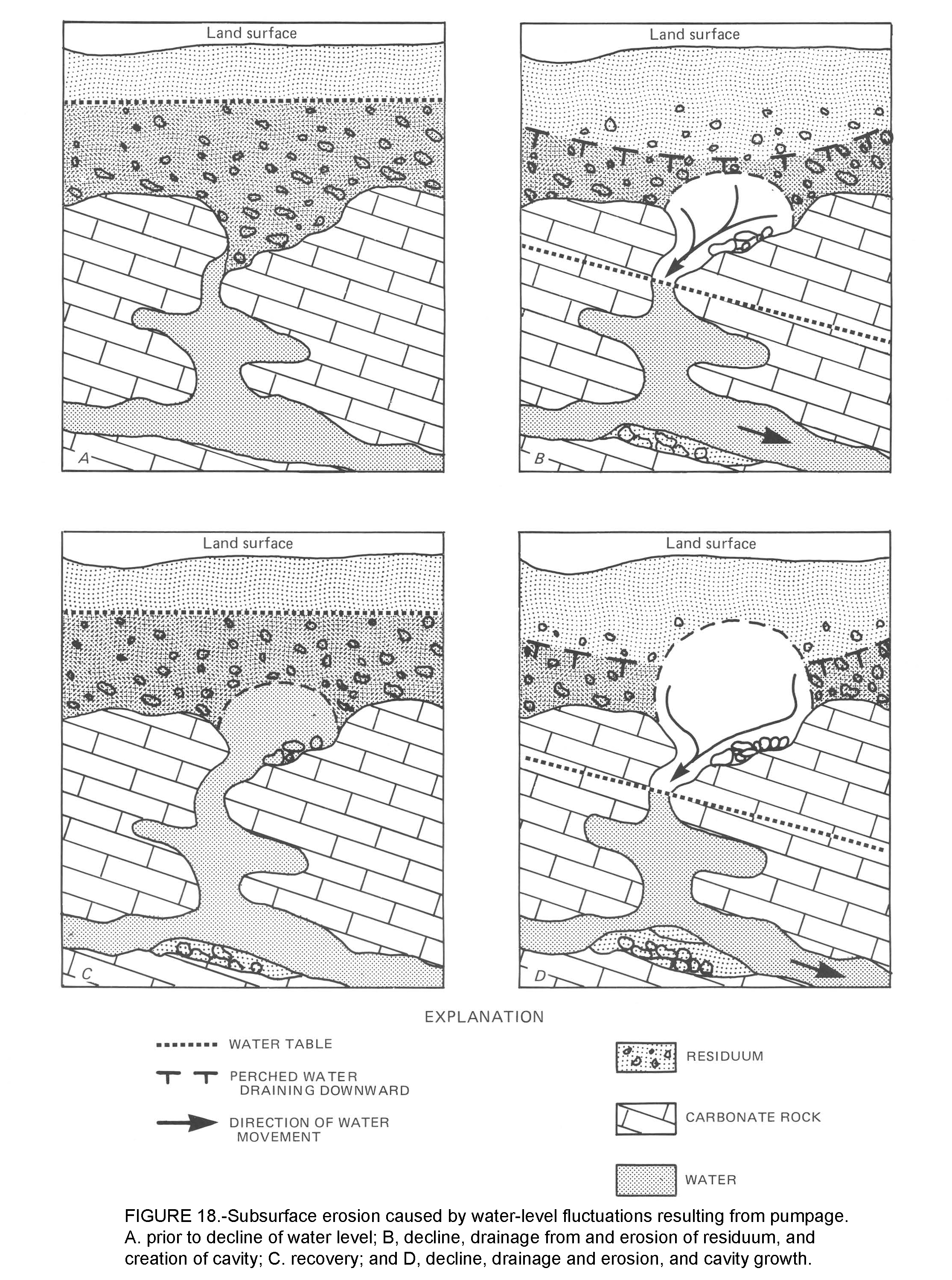
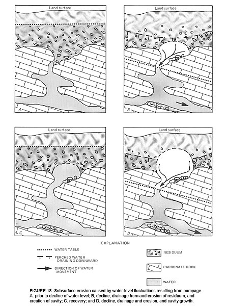
Illustration of "erosion from below" shows how the fluctuation of the water table above and below the soil-rock contact develops cover collapse sinkholes. This is Figure 18 on pages 22 and 23 of Newton, John G., "Development of sinkholes resulting from man's activities in the eastern United States", US Geological Survey, 1987, CIRCULAR 968. Available at https://pubs.usgs.gov/circ/1987/0968/report.pdf
Lisanslama
Subsurface erosion of soil into karst conduit by water level fluctuation.jpg adlı görüntü kamu malıdır çünkü içeriği, ABD İç İşleri Bakanlığı (United States Department of Interior) bünyesindeki bir daire olan Birleşik Devletler Jeolojik Etüd (BDJE; United States Geological Survey, USGS) kökenli özgün malzeme ile ilgilidir.
Daha ayrıntılı bilgi için, bakın: BDJE'nin resmi telif hakkı uygulaması.
|
Dosya geçmişi
Dosyanın herhangi bir zamandaki hâli için ilgili tarih/saat kısmına tıklayın.
| Tarih/Saat | Küçük resim | Boyutlar | Kullanıcı | Yorum | |
|---|---|---|---|---|---|
| güncel | 00.45, 4 Mayıs 2019 | | 2.231 × 3.000 (2,83 MB) | wikimediacommons>RockDoc485 | Illustrates how the fluctuation of the water table above and below the soil/rock surface develops sinkholes. Figure 18 of Newton, John G. "Development of sinkholes resulting from man's activities in the eastern United States". US Geological Survey, 1987, CIRCULAR 968 on pages 22 and 23. Available at https://pubs.usgs.gov/circ/1987/0968/report.pdf |
Dosya kullanımı
Aşağıdaki sayfa bu dosyayı kullanmaktadır: